Pensacola International Airport (PNS)
Driving Directions / Travel by Car
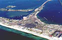
(Pensacola, Florida - FL, USA)
Situated to the northeast of downtown Pensacola, the busy Pensacola Regional Airport (PNS) is within easy reach of two interstate highways and the Jacksonville to New Orleans Highway 90.
Standing in the city suburbs, Pensacola Airport is bordered to the south by the Summit Boulevard, which links to Bayou Boulevard, North 9th Avenue, the US-296 and the Scenic Highway, running along the coastline.
Close to both the East Pensacola Heights and the Cordova Mall, Pensacola Airport is located directly north of the Bayou Texar and the bay bridge. On the northern side of the airport, Creighton Road runs parallel with the I-10 Interstate, near to the University Mall, the North Davis Highway and East Burgess Road.
Directions to Pensacola Regional Airport (PNS) from the north:
- Take Highway 29 and the I-110 heading south
- Exit the I-110 at Exit 5 east onto Highway 296
- Turn left onto Summit Boulevard and then take Service Road for the airport
Directions to Pensacola Regional Airport (PNS) from the south:
- Take the I-10 north
- Take Exit 4 east onto East Fairfield Drive
- Merge onto North 12th Avenue, Summit Drive and Service Road for the airport
Directions to Pensacola Regional Airport (PNS) from the east:
- Head west on the I-10 east, taking Exit 17 onto Highway 90 south
- Turn right onto Summit Boulevard and then right again onto Service Road for the airport
Directions to Pensacola Regional Airport (PNS) from the west:
- Highway 296 comes into the airport from Bellview and the west
- From out of town, take the I-10 east, the I-110 south, exiting at Exit 5 east
- Turn left onto Summit Boulevard and then Service Road for the airport
If you are driving to the airport from downtown Pensacola during rush hours, allow extra time for possible delays, while those coming from the east should allow more time when traveling to the Pensacola Airport along Highway 90 during morning and afternoon, when main roads can be busy.
Pensacola International Airport (PNS): Virtual Google Maps
